Precision includes many features that help increase productivity while providing the operator with important information and support to make wise decisions.
Simplified working day thanks to smart functions
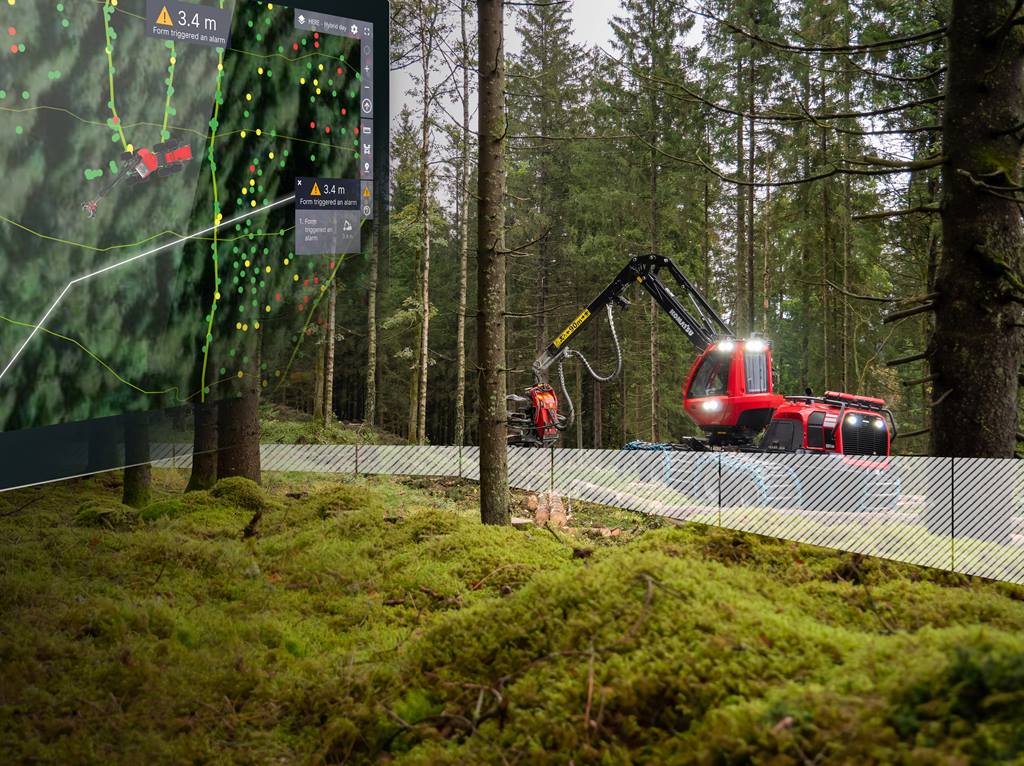
With geofencing, it is possible to draw in digital fences when planning the object, around the work area or to mark a protected area. Selectable alarms then alert the operator if the machine is too close to the border, providing extra peace of mind. The high precision also provides advantages such as being able to mark boundaries and areas digitally, based on map data from, for example, drones or LiDAR scanning. An accurate visualisation of the machine on the map as well as higher resolution map layers are other practical features.
Another area of use is stem code visualisation, which means that individual stems can be visualised with stem codes based on, for example, biodiversity considerations. Stem coding supports the operator in their work, enabling them to make better decisions more easily. It will also be easier to comply with directives, such as distances between future trees. Precision can also show the exact position of the felled logs, not just where the tree was cut. This feature allows the operator to know exactly where the timber is, even when it is dark or has snowed. This will also make it easier to see the assortment found in each log pile or at the roadside.
Support for line following and improved user experience among the new features
Precision is constantly evolving, and new features are being added. New for this spring is the feature guidance support for line following, which helps the operator stick to a particular path. The person planning the route also sets limits for deviations and if the machine starts to deviate from the planned course, a guide will support the operator in how to navigate back to the line. This function is very useful when planning, for example, strip roads.
It is also important that the user experience is as smooth and intuitive as possible. A new feature is the ability to set zoom levels for different working modes. The zoom is automatically adjusted during work based on the operator’s presets, ensuring a more seamless experience throughout the working day. The functionality of the map layers has also been improved. For example, it is possible to import data layers, activate boundaries such as area boundaries, and add detailed information about a data layers. A new feature also allows the operator to select how felled stems should be visualized on the screen. Either as individual logs for full control of production or grouped together to give a good overview.

The Precision solution grows with smart benefits
MaxiFleet
March 14, 2024
Komatsu’s digital solution Precision opens up new opportunities to work in a smarter and more efficient way. Thanks to technological developments, it is now possible to show the machine's position to within just a few centimeters, providing the foundation for many functions that facilitates the forest machine operator’s working day. Precision is now expanding with more useful benefits, such as line following with guidance support.